Larus Park
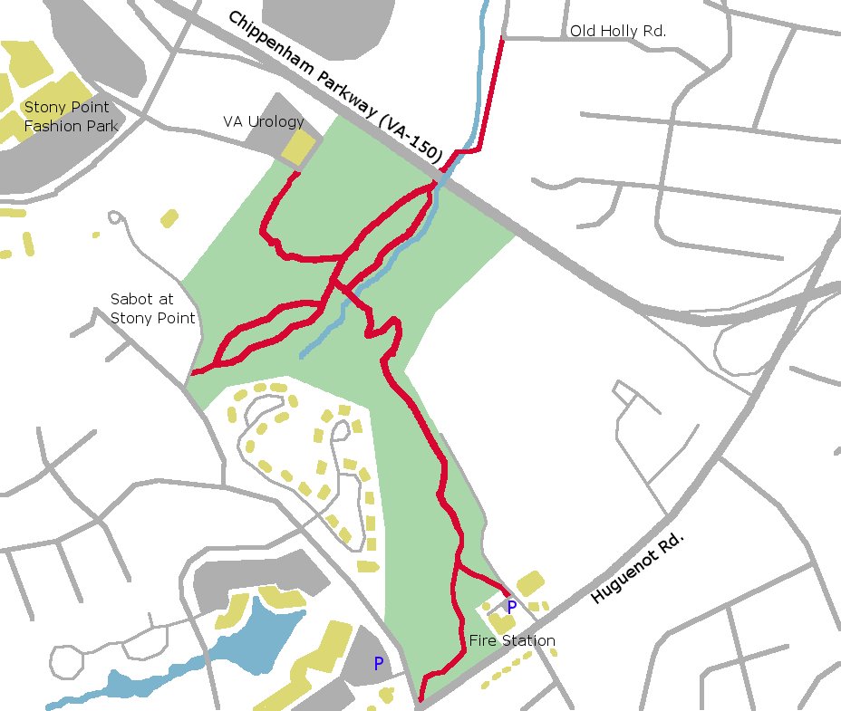
While owned by the city since 1978, Lewis G. Larus Park was not formally developed until 2006. The 106 acre park has approximately 5 miles of trails. These trails are mainly used by hikers and dog walkers so please use caution is traversing them by bike. Most the the trails can be considered easy to moderate with more difficult section towards the northern end of the park.
Directions:
By Car:
The main trailhead is located behind Fire Station #25 on Huguenot Road just south of the Chippenham Parkway. There is parking for two cars in the gravel lot by the cell tower (please do not park in the Fire Station’s paved parking lot). Other trailheads are located at Stony Point Rd. and Huguenot Rd., the entrance to the Sabot at Stony Point, the far right of the Stony Point VA Urology building and via a trail from Old Holly Rd. and Beechmont Roads.
By Bike:
Larus Park is accessible by low traffic roads (~3.25 miles) from the Pony Pastures via Huguenot Flatwater. From the main Pony Pastures parking lot, head west (upstream) on Riverside Drive. After passing under the Huguenot Bridge, turn right following Riverside Drive. Riverside drive will turn left from the river and become Hickory Road. Carefully cross Cherokee Rd. and take the first right on Rustic Rd. At the end of Rustic Rd. turn left on Oakleaf Rd, then right on Old Holly Rd. At trail heads off to the left where Old Holly ends at Beechmont Rd.
Map of Bike Route from Pony Pastures