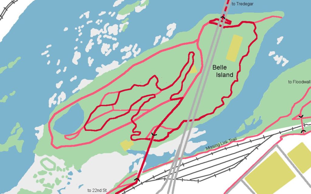
Belle Isle
A popular island in the middle of the James River which is only accessible by two bridges (a pedestrian footbridge and a service bridge for emergency and park vehicles). There are two sections of trail on Belle Isle. The “Lost Trail” is located on the eastern edge of the island, and is a flat, flowing trail with a few bermed turns. The other section of trails are located on top of the hill in the middle of the island. Connecting these two trail sections is the “Lost Garden,” the longest rock garden in the area under the service bridge. The trails on the top of the island are moderately more difficult, with tight singletrack riddled with lots of roots and tight turns. There are great view of the river from the top of the hill near the western side of the island.
Belle Isle is home to the Belle Island Bicycle Skills Area where you can learn new skills that will help you navigate the rest of the trail system.
History:
Belle Isle has a long history dating back to Capt. John Smith who explored the island in 1607. It has been home to a fishery, ironworks and a power plant. During the Civil War it served as a POW camp. The Island was turned into a park in 1973 and the suspended pedestrian bridge opened in 1988.
Directions:
The main parking area for Belle Isle is at Tredegar. You then take the suspended predestrian bridge under the Lee bridge across the James River. Access from the south side is via a pedestrian bridge over the railroad tracks at 22nd Street and the service vehicle bridge.